|
by Eldon Gemmill
“So you’re going up
the big Nahanni? Boy, you’ve bitten off something this time!
They say there’s canyons
in there thousands of feet deep, and water coming through faster’n hell.
But, people have just
got through – there must be some ledges or something where a man can tie a
canoe and camp and sleep?
I don’t know. There
ain’t many that have come back to tell about it.
Men vanish in that
country. There were some prospectors murdered in there not so long ago, and
down the river they say it’s a damned good country to keep clear of . . . “
Advice given to Raymond Patterson on his way to the Nahanni
in 1927.
In: The Dangerous River
From: Hartling, Neil. 1993. Nahanni: River of Gold – River of Dreams.
The De Havilland
twin engine Otter aircraft roared across Rabbit Kettle Lake toward a solid wall
of trees. Just as it seemed too close to be able to stop, Jacques eased back on
the stick, and the canoe sized pontoons broke free from the water’s surface. We
skimmed over the tree tops and a magnificent landscape came into view before
us. Mirror like lakes embedded in an emerald green sea of sea of spruce,
willow, and alders with rivers sometimes, sometimes with shining rapids,
gliding down nameless valleys. A startled bull moose frantically splashed out
of a pond into a willow thicket below us. The jagged 200 million year old
granitic peaks of the Ragged Range demarked the distant western horizon. This
is the Nahanni Country of Canada’s Northwest Territories – a remote, unspoiled
wilderness where my daughter, Marin, three old canoeing friends, Don Jacobs,
Frank Carpenter, and his son Justin, and I had come for two weeks of adventure,
personal challenge, and contrast to our comparatively routine lives in suburban
Maryland. We were on our way home now. I couldn’t help but remark to the pilot
that the view from his “ office window “ was much better than the one from mine
back in Maryland. Of course, it isn’t always that way. On the trip in, we were
dodging storms and snow squalls as the single engine Cessna we were aboard
plied its way among the high peaks – sometimes just off our wing tips. A small
mishap there compounded or an engine failure could mean certain death. This
too, is all in a day’s work for a northern bush pilot.
Some of our group
had been to the Nahanni in 1996. For that trip, Jacques and his Otter dropped
us onto a gravel bar along a narrow stretch of the river about midway on its
310 mile journey from high in the Selwyn Mountains to the Liard River at
Nahanni Butte. We had portaged our canoes and gear around Virginia Falls at 390
ft. in height – twice as high as Niagara Falls, and paddled down the four
narrow canyons, ranging from 3,000 – 4,000 feet deep that seemed to close out
the sky overhead. We ran the six foot high standing waves that left little room
for error in the 52 degree F. water. The South Nahanni or Nahanni, as it is
usually called, was considered by the late Bill Mason, artist, film maker, and
author of “Path of the Paddle” as “still the greatest canoe trip in the World”.
It was designated as the first World Heritage Site in 1978 in recognition of
its unique, diverse, and spectacular character. The Nahanni is legendary with a
rich heritage of human prospect, toil, and tragedy in their efforts to unlock
her secrets. Places such as the Headless Valley, where the McCloud brothers’
headless skeletons were found in 1908, Hells Gate, the Funeral Range, Vampire
Peaks, and Cirque of the Unclimbables reminisce of past events for those
prospectors, trappers, and explorers who once ventured into this vast, brooding
land. Like so many others, we too, became incurably drawn to this pristine
wilderness, and vowed to return someday.
In early July of
1999, we came back to Fort Simpson, NWT – the main jumping off point to the
Nahanni. From this small outpost at the junction of the Liard and Mackenzie
Rivers, we would fly approximately 300 miles northwest to the Moose Ponds – a
series of small glacier and snow pack fed lakes (elevation ~ 4,000 ft above sea
level) in the mountains at the source of the Nahanni River. At Ft. Simpson, we
met Mr. David Hibbard, our outfitter and guide, and his son Joel. Also joining
us were Conrad Janzen, who guides for David, and who would be guiding Mr. Les
Morgan and Mr. Ted Wiedener, both from Calgary. David owns a company called
Nahanni Wilderness Adventures having a sub-base in Ft. Simpson during the
Summer season. We Marylanders opted for a guided trip due to the logistics of
obtaining the canoes, food, and gear that all would now be taken care of for
us. Further, David was experienced on the upper Nahanni, and the named Rock
Gardens that consist of about 30 miles of wild, challenging, boulder strewn
white water rapids descending at a strong gradient averaging over 30 ft. per
mile. This stretch is recommended for expert canoeists. Unlike the middle and
lower Nahanni, there are only two or three small groups who do this trip by
canoe each year. The second part of our journey was to be an overland
hike/climb up into the Cirque of the Unclimbables in the Ragged Range among the
highest peaks in the Northwest Territories. As we were told and eventually
learned first hand, this too is a challenge – of a different kind.
Due to the high
winds and snow at 5,000 ft in the mountains on July 4, it took the next couple
of days to get us all flown two–by–two, into the base camp at the Moose ponds
via. A single engine, Cessna. As we passed through narrow gusty passes and snow
squalls we were glad that our pilot, Mr. Ted Grant was so experienced and
capable with the controls. Ted was very knowledgeable about the area and during
the flight he shows us numerous points of interest. We heard more of those
descriptive place names such as Portrait Lakes, Broken Skull River, and Sunblood
Mountain. Our tiny plane with our canoe attached to a pontoon and gear touched
down on the Lake about 10 PM, after a 3 hour flight. The midnight sun had
dipped below the horizon, but this far North, there was plenty of light to see
by. After a quick, 15 minute off-load, Ted was back up into the air, and his
navigation lights soon faded into the southern horizon. Meanwhile, Conrad and
Joel had already cooked up some hearty stew. The long flight had peaked our
appetites and we devoured it handily. This first campsite was very picturesque,
because the majestic, snow capped image of Mt. Wilson, rising 4,000 ft above
the western side of the lake was perfectly mirrored in the water.
During our stay
at the Moose Ponds, we spent a day bushwhacking up onto Mt. Wilson. From that
vantage point right on the Continental Divide, we could look down on the Ross
River just beginning its journey westward through the Yukon Territory on its
way to the Gulf of Alaska via. the mighty Yukon River. In a marshy flat below,
there were two caribou grazing on the
summer vegetation. The youngest set of our group climbed almost to the summit
of Mt. Wilson until a lightening storm forced them to retreat. We “more mature
and seasoned” individuals with our
collected ailments chose to be happy with making to the base of the
steep, boulder armored part. That night, we all appreciated our warm sleeping
bags as the temperatures dropped enough to frost by morning. We had timed our
arrival here for early July in order to catch the narrow window between ice-out
of the Moose Ponds, and the later
decreased river flows following the early snow melt runoff.
The next morning
was one we had long anticipated. We were going to paddle down river into the
Rock Gardens. We loaded the five 18 foot long plastic canoes each with two
plastic olive barrels of food, tents, stoves, sleeping bags, and other gear in
preparation for the next two weeks. We paddled down the outlet of the Moose
Ponds, negotiating over two beaver dams on the way, and on down the narrow,
winding Nahanni. The River started out being no wider than a canoe length. As
we continued along, it gradually increased in size, volume, and velocity as in flowing tributaries added their waters to the still fledgling river.
Eventually, Mt. Wilson passed into the background, the river changed and a few
small rapids began to appear. Mile after mile, the river and rapids grew. We
camped that first night on a shoreline just above Initiation Rapids, the true
beginnings of the Rock Gardens’
challenging whitewater section.
On the morning of
July 9, we secured all cargo, fastened on the spray decks, donned wetsuits and
crash helmets, and headed downstream. We soon reached Initiation Rapids – a
steep, boulder choked rapid that merited scouting. Everyone ran it successfully
and was exhilarated by the level of capability this rapid demanded – bracing,
back paddling, and eddying-out skills were absolutely essential. With our
courage stoked, we continued down river through raids with names like Descente, and Thread the Needle. The volume and pushiness of the river steadily
increased. The heavily laden canoes were hard to maneuver among the omnipresent
boulders, turns, cross currents and souse holes of the rapids. Fortunately, the
slippery ABS plastic hulls of the canoes usually slid off the boulders that we
hit. Still, a serious injury of damaged hull was a concern, because we were
days away from any kind of outside help should such a mishap occur. We were
glad that David, with his knowledge and experience in the Rock Gardens was with us to help guide us along. By the end of the
day, everyone was pretty tired and glad to make camp. We had put in a lot of
hard work, including the intense concentration required to read the water ahead
for hours on end.
The third morning
some of us noticed a few butterflies in the stomach as we wondered what was in
store on this final day in the Rock Gardens. We weren’t disappointed. We worked
our way through Danish Dynamite, Junction, and Bailing Rapids – also known as the
White Mile – a long, long, long rapid. Then a break – 7 miles of just fast
current. This, however, was a prelude to the grand finale - Hollywood and
Sequel Rapids. These were very powerful and tricky Class 4 rapids. The former
had the full current of the river thrown into a sharp, boulder ridden right
hand curve. It then funnels through narrow chutes and over ledges with high
standing waves. Hollywood is reported, to have already claimed a canoeist. Sequel
also had a tricky approach to a narrow chute that suddenly comes into view. The
entire river gushes through and over a high ledge. The water plunges through
like a fire hose forming a huge reverse hydraulic at the bottom. Without fail,
the entire front half of our canoes dove underwater as they shot down into the
tumultuous maw below. Thank God for the spray decks! We bounced, one by one,
down the diminishing series of standing waves below Sequel as we were at once,
exhilarated, relieved, and saddened knowing that the Rock Gardens were now
behind us. We made camp that evening just as a rain squall hit. By dinner’s
end, the sun was back out and a rainbow arched overhead and down the valley
somewhere. Upon seeing that, our Canadian travel mates related a favorite
saying, “At the end of every rainbow . . . is a rapid”.
Sunday, July 11,
Journal Entry: “We broke camp in a light drizzle. Water and air temperatures
both 50 degrees F. We proceeded down river toward Island Lakes ( appx. 40 mi.).
The current was strong and we reached the outlet by 7 PM. We wound our way up
the outlet, hauled over the obligatory two beaver dams, and onto a tranquil,
narrow lake. Soon camp was made and Joel and I took a canoe over to the inlet
near a large beaver lodge where we caught some nice lake trout for dinner on
small metallic spoons and spinners. Later, as we sat around the campfire, a
lone wolf howled somewhere across the valley. There is something very ancient
that seems to stir deep within the human soul, upon hearing that wailing sound
rising and then falling into the silence of the wilderness night. The next
morning, Joel and Eldon went back and caught more 15” sized trout for
breakfast. Also, in the early morning hours, a black bear visited camp and got
into the dishwater. He managed to inhale a snout full of the sudsy solution and
went off in a huff – shaking his head and frothing bubbles out of his mouth and
nose. Wild bears see to hold a fascination for soap. We were happy enough that
our only encounter with Mr. Bruin ended humorously.”
On July 12 we
left Island Lakes to the beaver, the trout, and the bear. Our first stop was at
Moore’s Cabin, built in 1978 by its
namesakes, a newly wed couple who chose an unusual honeymoon. They came to this
location, built a cabin, and spent their first year of marriage hunting,
fishing, trapping, and living off the land. They relate the story of this
adventure in “Nahanni Trail Head”
(see Further Reading List). Their cabin is still in fair condition, and those
who stop by often leave their names on miniature carved paddles that they
suspend from the rafters by fish line. A short distance below the cabin is Moore’s Hot Springs – a shallow
tributary that has a geothermal source near its confluence with the Nahanni.
The water ranges up to 140 degrees F. Since we all could use a bath by now, we
spent a relaxing hour or so wallowing in the hot mud and then rinsing in the
clear water of this unusual stream. The heated ground and surrounding air
creates a micro-environment here that supports a lush growth of cow parsnip and
other unique species not seen elsewhere except at Krause’s Hot Springs farther down river. An endemic mosquito
population seems to come with the package here as well.
After two more
days paddling and lazily drifting (often rafted together) down the fast current
of the Nahanni, we reached Britnell Creek and the beginning of the overland
phase of the trip. Our group split up with Conrad, Ted, and Les who headed on
down river. The rest of us crammed four days of provisions, stove fuel, tents,
and other gear into our back packs and headed into the bush generally following
Britnell Creek. The trail was a literal obstacle course with constant fallen
trees to crawl under or over, swamps to slog across, and thickets to tunnel
through. It was easy to lose the path or confuse it with game trails. Ever
alert for grizzly, especially in low visibility areas, we kept the bear spray
handy. After a punishing six hour slog up the valley, we came out upon Glacier
Lake, a narrow, three mile long, milky green colored body of water fed by
several glaciers emanating from the nearby peaks. To reach the campsite at the
opposite end of the lake, it meant either to walk along the rough shoreline or
patch over two of the canoes we found stashed at our end of the lake. One canoe
needed the keel line sealed with duct tape, and the other needed extensive
patch work on the bow where a grizzly had chewed on it. With this handiwork
done, we continued by water, bailing the leaky canoes as we went. The
prodigious leaking was due, in no small part, by our loading them with four
persons plus gear each. The meaning of freeboard was stretched to the limit!
Camp that evening was among the tall spruces at the upper end of the lake. Soon
after a quick, hot meal, only the snoring from out tents broke the twilight
silence of the boreal forest.
The next morning
we arose stiff and sore, broke camp, and headed up the valley. Eventually, we
turned up onto the foot of a huge boulder slope that seemed to rise forever.
After several hours of hard and treacherous climbing up the 50 degree slope,
the boulders ended. A landscape of green, rolling meadows opened before us as
an amphitheater surrounded by towering, vertical walled peaks jutting up from
the valley floor for hundreds of feet. These cathedral like granite towers are
a renowned challenge among expert climbers worldwide who come by float plane to
Glacier Lake to scale these heights. To the left, a large glacier, retreating
grudgingly in the July heat, supplied a medium sized brook that meandered
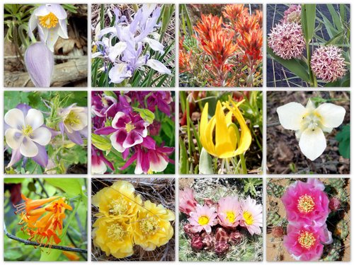
through the high meadow. Blooming alpine wildflowers were everywhere, and dark,
house sized boulders covered with lichens dotted this surreal landscape as if
placed by a divine hand. This area is known as the Fairy Meadows. It seemed
like a fantasy world evoking parallels with J.R.R. Tolkien’s tale of “The
Hobbit” where Gandalf, the wizard led his little group into the Misty Mountains
of Wilderland. Even Glacier Lake had its counterpart as the “Gateway of the
Long Lake” at the head of the “Running River”. We spent the night there and
hiked, and photographed this unique place the next morning. The “fairies” of
the Cirque even made an appearance. They are scattered colonies of Richardson’s
Ground Squirrels who live seemingly idyllic lives sleeping underground through
the long winter, and frolicking in the long, warm days of summer. In the
afternoon, we refilled our water bottles, and headed back down the boulder
field toward the lake. An occasional unstable boulder and steep gravely patches
made the descent difficult and a bit treacherous. We knew we were out of our
element when we looked to the side and spotted two mountain goats watching us
with some amusement we conjectured. Don got himself bloodied up when he lost
his footing on one such area and fell over an eight foot ledge. Shaken, but not
deterred, he and we continued on, reaching the lake camp by our usual stopping
hour – 11 PM.
Two days later,
we found ourselves swimming and relaxing in the 70 degree F., clear blue waters
of Rabbit Kettle Lake and the end of our journey. Jacques and his Otter landed
to whisk us, all too abruptly, back to civilization. The combination of
canoeing and hiking overland during this 15 day trip from Ft. Simpson was
ideal. Using different sets of muscles, requiring different skills worked out
well both physically and psychologically. We felt we were able to sample some
of the best of both worlds in terms of natural features, plants, and wildlife
in this unique and diverse subarctic region. We had only scratched the surface,
but we learned a few more of the Nahanni’s secrets. Someday we hope to return
to learn more.
ERG: Dec., 1999
Further Reading
Hartling, Neil. 1993, Nahanni . .
. River of Gold, River of Dreams.
CRCA., Ontario.
Jowett, Peter. 1993. Nahanni . . .
The River Guide, Rocky Mountain Books, Calgary.
Mason, Bill. 1980. Path of the Paddle. Toronto: Van Nostrand
– Reinhold.
McCreadie, 1996. Canoeing Canada’s Northwest Territories.
Canadian Recreational Canoeing Association, Ontario.
Moore, Joanne R. 1980. Nahanni Trail Head. Ottawa: Deneau
and Greenberg Publishers Ltd.
Morse, Eric W., May, 1967. Summer Travel in the Canadian
Barrens. Canadian Geographic Journal. Ottawa.
Patterson, R.M. 1966. The Dangerous River. Toronto: Gray’s
Publishing.
Turner, Dick. 1989. Nahanni. Surrey, B.C. : Hancock House
Publishers Ltd.
Other Resources
Nahanni Wilderness Adventures. David Hibbard: Phone: 403-678-3374.
Website: nahanniwild.com
Little Nahanni River (105-1). 1:250,000 scale Topographic
Map with 100 meter contour intervals from the Moose Ponds through the Rock
Gardens to just downstream of Moore’s Hot Springs to the top of the Nahanni
National Park ( in 1999). Available from: The Canada Map Office, Dep’t. of
Energy, Mines and Resources, 615 Booth Street, Ottawa, Canada, KIA 0E9., 1987 Series.
|